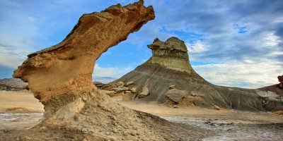
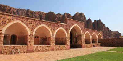
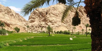
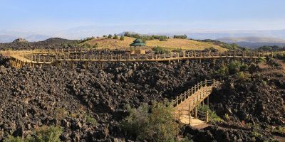
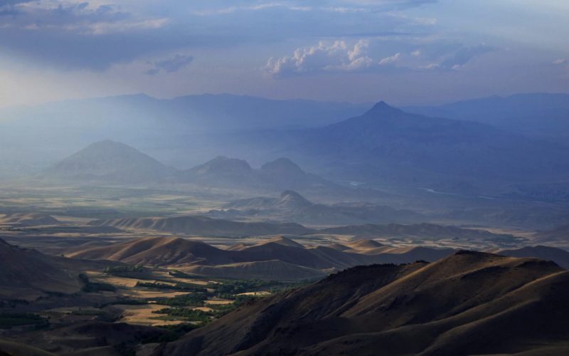
Cooperation with Bahabad Municipality started in July 2023 with the geopark potential studies and pre-establishment activities.
Since July 2023
- Potential studies of Bahabad Geopark
May 2023
Cooperation with Balikasir Municipality and Ida Madra Geopark in Turkey started in May 2023 with pre-establishment and clearing of the UNESCO Global Geoparks rejection recommendations.
August 2021
Cooperation with Chabahr Free Zone started in August 2021 with local products and handcrafts consultation project and it continued till now with working on local community engagement, designing new products, packaging for existing products and holding training workshops and etc.
- Designing hand crafts and packaging for existing products
- Local community engagement consultation
- Holding training workshops
Since March 2020
Geoscience Institute of New Age joined the GEOfood for sustainable development in UNESCO Global Geoparks IGCP Project No. 726 as a Project Steering Committee Member.
The project goal is to carry out research on the link between geoheritage, geodiversity,
ecosystem services, food production and sustainable development through the implementation
of an innovative brand – GEOfood
Analyzing these relationships in depth is essential to understanding the local identity of a UGGp
in all its cultural, social and economic aspects (use of natural-geological resources). This will be
used as a basis for developing strategies to fulfill the IGCP broad objective: Increasing
understanding of geological processes and concepts of global importance, including an
emphasis on socially relevant issues.
Since March 2015
Cooperation with Qeshm Island UGGp started in March 2015 with Geoproducts project and it continued till now with working on local community engagement, designing interpretation boards and etc.
- Geoproduct consultation and design
- Designing interpretive boards, stands and posters
- Local community engagement consultation
- Re-validation application dossier preparation member
- Designing geopark’s museum boards
- Holding training workshops
- Designing new hand crafts and packaging
- estimating the accommodation potentials and standardization of accommodations
- Local community engagement consultation
- Holding training workshops
September 2017
Cooperation with Aras UNESCO Global Geopark started in September 2017 with the Geoproducts consultation project and it continued till now with working on local community engagement, designing interpretation boards, etc.
- Geoproduct consultation and design
- Designing interpretive boards, stands and posters
- Local community engagement consultation
- Holding training workshops
- Application dossier preparation member
- Geopark and Geosites map preparation
- Geopark’s partners evaluation
October 2017
Cooperation with Tabas UNESCO Global Geopark started in October 2017 with a Geoproducts consultation project and it continued till now with working on designing interpretation boards, etc.
- Geoproduct consultation and design
- Designing interpretive boards
- Holding training workshops
June 2019
Cooperation with Kula-Salihli UGGp in Turkey started in June 2019 with a pre-evaluation consultation project and it continued till now with working on geoproducts and holding online workshops.
- Geoproduct consultation and design
- Holding online workshops
September 2019
Khuzestan Province is one of the Iran’s provinces. It is located in the southwest of the country, bordering Iraq and the Persian Gulf. As the Iranian province with the oldest history, it is often referred to as the “birthplace of the nation”, as this is where the history of the Elamites begins. Iran National Heritage Organization lists 140 sites of historical and cultural significance in Khuzestan, reflecting the fact that the province was once the seat of Iran’s most ancient empire. Tourism Potentials Study in Khouzestan Area has been done under supervision of Alireza Amrikazemi, Geological survey of Iran
On July 2017
Aras Geopark is located in East Azerbaijan Province of Iran. The Geopark has an area of about 1670 square kilometers and spread across the whole Julfa County. From a natural geographical view, this mountainous area is the southern end of little Caucasus that encompasses countries include Armenia, Nakhchivan Autonomous Republic and northern Azerbaijan of Iran. This mountain alongside with Alborz and Zagros are forming middle part of Alpine-Himalayan Orogeny that stretches from southern Europe to eastern Asia and acting as a natural barrier, caused a great diversity in climate, life and cultures in each two sides slopes. Geotourism studies in Aras Geopark has been done in cooperation with geoheritage institute of the Middle East (GEOHIM), under supervision of Alireza Amrikazemi, Geological survey of Iran.
November 2015
Lorestan Province is located in west of Iran in the Zagros Mountains and it covers an area of 28,392 km2. The terrain consists chiefly of mountains, with numerous ranges, part of the Zagros Chain, running northwest to southeast. The central range has many summits that almost reach the line of perpetual snow, rising to 4000 m and more. It feeds the headwaters of Iran’s most important rivers. The highest point of the province is the Oshtorankuh peak at 4,050 m. The low-lying areas being in the southernmost sector of the province are approximately 500 m above sea level. Oak forest covers the outer slopes, together with elm, maple, walnut, and almond trees. Geotourism studies in Lorestan Area has been done in cooperation with geoheritage institute of the Middle East (GEOHIM), under supervision of Alireza Amrikazemi, Geological survey of Iran
August 2014
Kashan is a city in the northern part of Isfahan province, Iran. Some etymologists argue that the city name comes from the Kasian, the original inhabitants of the city, whose remains are found at Tapeh Sialk dating back 9,000 years; later this was changed to “Kashian”, hence the town name. Between the 12th and the 14th centuries Kashan was an important centre for the production of high quality pottery and tiles.
Kashan is divided into two parts, mountainous and desert. In the west side, Kashan is cited in the neighborhood of two of highest peaks of Karkas Chain, Mount Gargash to the southwest of Kashan and Mount Ardehaal in the west of Kashan.
The east side of Kashan opens up to the central desert of Iran, Maranjab Desert and Salt Lake. Geotourism studies in Kashan Area has been done in cooperation with geoheritage institute of the Middle East (GEOHIM), under supervision of Alireza Amrikazemi, Geological survey of Iran

